
Color dot map |
USEPA |
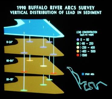
In this outline map of a river bend, colored dots depict concentration ranges of a contaminant (lead) at 2-3 levels in vibracores from different locations. This style of graphic is well suited to highlighting "hot spots" occurring within cores at certain stations. |